A blog for better streets and public spaces in Portland, Maine.
Showing posts with label pavement pollution. Show all posts

Thursday, February 21, 2019

Why is Portland wasting affordable housing funds on empty parking lots?

Last night the city of Portland declared a parking ban in advance of a snowstorm, which means that everyone had to move their cars into off-street parking lots.

And here's what the 22-space parking lot at Avesta Housing's Bayside East building (a low-income housing complex for seniors) looked like:

There were two more cars parked in the handicap spaces outside of the shot, but still, this is what I'm talking about when I kvetch about the wastefulness of Portland's and MaineHousing's parking requirements.

This parking lot was paid for in part from Maine's Low Income Housing Tax Credits, which are a) extremely limited and b) intended to subsidize affordable housing, not to subsidize our most unaffordable form of transportation.

Building this parking lot forced Avesta to set aside more than half of its 1/3rd acre parcel (adding ~$150,000 in land costs to the project) for pavement instead of for housing. What is today a 20-unit apartment building could have housed *twice* as many low-income households if the city and MaineHousing had not forced them to waste this real estate.

And, on an ongoing basis, this parking lot also forces Avesta Housing, a nonprofit agency, to spend thousands of dollars every year plowing, sanding, patching potholes and paying stormwater fees for an ugly field of asphalt that, as it turns out, their tenants don't want even when it's being given away for free!

Over the years, Portland's affordable housing developers have pissed away millions of dollars' worth of our state's limited low-income housing funds to build parking lots and garages like this one. Imagine how great our bus system could be if that money had been spent on METRO improvements instead.

Maine has over 30,000 renter households that don't own any cars, and Portland is one of the few places in the entire state where those families can live well without an automobile.

It's plainly wrong to mandate that a parking lot is the best way to solve low-income renters' mobility needs. Given the extortionist terms of subprime auto loans and the high costs of car maintenance, expecting low-income tenants to bring their own cars instead of helping them pay for transit passes is borderline sadistic. These families need apartments and better transit service much more than they need free parking, and Portland, as a city, needs planning laws and low-income housing financing rules that recognize this fact.

Monday, December 7, 2015

Bigger bumpouts aren't always better

The first phase of construction to narrow down the failed Spring Street urban-renewal scheme is just about complete, and for the most part, it's an improvement: the ugly median barrier is gone, there are fewer lanes of traffic, sidewalks are wider, and bike lanes are coming soon.

But even with the improvements, Spring Street still feels like a forlorn, too-wide speedway through empty parking lots. The hope is that some of those parking lots will soon transform into buildings, and then Spring Street might feel more lively. But for the time being, it's still a sad place.

The weirdest part of the new street is probably at the western end of the project, where the 1970s urban renewal project ended. There, the old street quickly bottlenecked down from 4 lanes east of State to two lanes a block to the west. The traffic engineers' plan for eliminating that bottleneck in the new plan has been causing some controversy. Here's a cyclists'-eye view of what it looks like:

Photo by Steven Scharf

 That's Portland's newest, biggest sidewalk bump-out, sitting right in the middle of what clearly used to be the historic path of the old Spring Street.

Now, as much as I like bump-outs, this design is stupid.

On the north (right, in the photo above) side of this corner, there's a clearly-defined street wall defined by the Little Tap House building, mature street trees, and other historic buildings a little further on up the street. And on the south side, there's a city parking lot – a remnant scar of Spring Street's urban renewal demolitions and a prime opportunity for a new building that could activate the corner.

But for some reason, the engineers designed the new Spring Street to avoid the historic corridor. Virtually of the site's contexts – the buildings, the trees, the streetlamps – tell motorists and cyclists to "stay right", but the paint on the pavement says, "swerve left, then right."

This, unsurprisingly, is confusing people. The Press Herald even got photographs of a driver rolling their car right over the new bump-out. To the driver's credit, this is exactly what the street's visual cues suggest you should do. But if you're a traffic engineer looking at a blueprint of the intersection, you don't see those visual cues, or the intersection's historic context.

Portland Press Herald graphic

Here's another problem with the bump-out: the reason it's so huge - two lanes wide! - is because on the eastern side of the intersection, in front of the Portland Museum of Art, the new Spring Street incomprehensibly bloats to 3 lanes, including an idiotic double-right-turn lane. While the rest of Spring Street got a road diet, this particular section senselessly got a widening.

The sudden bloat in turn lanes is obviously confusing to drivers – the driver who got caught cruising over the bump-out is trying to drive straight on Spring from one of the new right-turn-only lanes. The intersection worked just fine when there were only two westbound lanes there, though. Getting rid one of the three westbound lanes there and restoring the former layout would be an easy short-term fix.

And here's my final beef with the bump-out. The city owns a parking lot on the south western side of Spring Street. Greater Portland Landmarks owns the building on the southeastern side of Spring Street. Both of those corners are prime opportunities to activate a new Spring Street with attractive new buildings that match the context of the historic neighborhood and honors the historic street wall.

If we were willing to shrink the bump-out AND sacrifice one of the new right-turn-only lanes, we could actually get more pedestrian space overall, and get a more sensible intersection, and put more city-owned real estate to work to create new housing. How about it, City Hall?


Tuesday, September 22, 2015

Portland Street pilot bike lane

The city has repaved Portland Street and re-striped its wide expanse of pavement to give us a short stretch of bike lanes between Deering Oaks and Preble Street:

(an aside: have you ever noticed the terminating vista of the City Hall clocktower at the end of this street? Too bad the Libra Foundation's huge white elephant parking garage squats in front of it to block most of the view. Also too bad the public market that that garage was supposed to support failed after just a few years in business – probably unrelated to the massive, expensive garage it was hitched to, right?)


At a recent meeting, I heard that these bike lanes are being tested on an interim basis while the city gears up for a more complete reconstruction of Portland Street in the next couple of years. So, if you like what you see here, consider sending a message of thanks to your local city councilor and the city manager.

And also consider asking the city to go even further with traffic-calming on Portland Street. Removing some of the street's excessive pavement now could pay off with thousands of dollars' worth in annual maintenance savings in the years to come:

  • Reducing the street width and adding trees at intersections with landscaped curb extensions
  • Replacing a handful of parking spaces with stormwater treatment infrastructure (the 'pilot' layout increases on-street parking significantly with angled parking near Preble Street, so some spots could be removed in other locations and still maintain a net gain for automobiles)
  • Narrowing the street and widening sidewalks between Brattle Street and High Street, where Portland Street had formerly ballooned to a four-lane roadway

Friday, November 14, 2014

Pavement polluters would pay for more sustainable infrastructure under proposed "stormwater charge"

During a 2-inch rainstorm, the parking lots and big-box rooftops of the "Pine Tree Shopping Center" and Quirk car dealership (pictured at right) dump about 1,500,000 gallons of oil-slicked runoff pollution into Portland's sewers, which proceed to overflow into the headwaters of the Fore River.

In a city that prizes its working waterfront and its locally-caught fish and lobster, this particular form of parking pollution is a big problem. The good news is that the city has committed to a $170 million upgrade of its infrastructure to handle this pollution. Even better: for the first time ever, parking lot owners, who are responsible for a substantial amount of the pollution, might actually foot a fair share of the bill.


Right now, sewers get paid for through our water bills; parking lot owners don't pay anything, even though their asphalt sends hundreds of millions of gallons of gasoline-slicked sewage into Casco Bay each year.

But for over a year now, the city's been holding public hearings on its proposed new "stormwater charge," which is its preferred way of paying for federally-mandated sewer upgrades for Clean Water Act compliance. The city's proposal would ask property-owners to pay fees in proportion to the amount of "impermeable surface" – rooftops and pavement – that they own.

This could be a significant step towards reducing the city's environmentally-destructive subsidies for motorists. Right now, parking lot owners are getting a free pass on the pollution they cause, but with the proposed stormwater charge, parking lot owners would be forced to pay to clean up Casco Bay.

In the short term, the fee will provide more funding for "green infrastructure" projects, such as traffic-calming sidewalk extensions that incorporate stormwater filtration gardens (like the one pictured at left, which was installed on Commercial Street earlier this year). And over the longer term, the new tax on pavement will help encourage more property owners to convert low-value parking lots to more productive, more urban uses – and encourage more motorists to leave the car at home.

The idea's got a lot of momentum behind it, but he city's also hearing a lot of opposition to this idea.  Anyone who wants to weigh in with a voice of support would help.

To learn more:
http://www.portlandmaine.gov/1331/Stormwater-Service-Charge

And to thank a city councilor for supporting this concept:
http://www.portlandmaine.gov/132/City-Council

Monday, September 29, 2014

Traffic engineers *still* want to widen Franklin Street

At left: Gorrill-Palmer Engineers' proposal for an 8-lane Franklin Street, blocking the Bayside Trail crossing between Marginal Way and Somerset Street.

This Wednesday, Oct. 1, will be the second public workshop for the Franklin Street redesign study. It starts at 5:30 p.m. in the main library's Rines Auditorium (on the basement level).

There's some good stuff being planned, but the team needs to be challenged – forcefully – on their proposal for the northernmost section near Marginal Way, pictured at left. 
 
Traffic engineers from Gorrill-Palmer – the same guys who proposed turning Franklin into a full-on freeway ten years ago – seem to have missed the long discussions about how this study's purpose was to make Franklin Street safer and friendlier to foot traffic. 
 
Instead, they've sketched out plans to widen Franklin from 6 lanes to 8 lanes north of Somerset Street. 
 
The proposal would make the intersection of Franklin and Marginal Way one of the most massive intersections in the greater Portland region – almost as big as the junction of Route 1 and Gorham Road at the center of sprawl-choked Scarborough.

The traffic engineers claim that extra lanes are needed to accommodate their forecast of 8% more cars by 2030. In other words, motorists will get more space to accellerate to freeway speeds, and pedestrians will get longer crosswalks and more opportunities to get maimed by motorists.

This section of Franklin would be the first section to be reconstructed (in 2016), so it's important to get it right – or at the very least, not make it any worse than it is today.

If you're coming to Wednesday's workshop, a good question to ask might be why we need 33% more lanes built in 2016 in order to accommodate science-fictional traffic that won't exist for another 15 years (if ever)?

Another good question to ask is whether the traffic engineers would be willing to film their children, or elderly parents, spend a weekday rush hour crossing this street on their own.


Monday, September 30, 2013

Asphalt requiem

Construction crews have had a busy summer in Portland tearing out pavement. 

Up on Munjoy Hill, a repaving project along the Eastern Promenade re-arranged the curbs at the entrances of Cutter Street and at Fort Allen Park to reduce crossing distances for the neighborhood's foot traffic. In this photo taken shortly after the construction was done, you can see where the pavement used to be as the brown spot where the new grass hasn't quite grown in yet. 

The old intersection seemed to have been designed to let tractor-trailer trucks make the curve at high speeds; the new one acknowledges that Fort Allen Park doesn't get a lot of high-speed cargo deliveries. It's a lot more pleasant for everyone — even for motorists, who get more time to enjoy the views by slowing down.


There's been a smattering of these spot improvements around town this summer. On St. John Street, they tore out a lane of pavement in front of the Union Plaza strip mall and planted it with shrubs, trees, and boulders. In this photo you can see the old curb (which they left) in the middle, and the newly 2-lane St. John to the right. 

On Park Avenue between St. John and Deering Avenue right now, they're tearing up the parking lane at key intersections to build wide landscaped esplanades. Here's near Hadlock Field:


...and at Deering Avenue, the new curb extensions will create shorter crosswalks between Parkside and King Middle School:


Around the corner on Valley Street, some urban-renewal-era road widening has been rearranged with some nice new landscaped median islands.

Before (in 2011):

And today:

Aside from looking nice and making the streets safer for everyone, these projects are saving the city some real money. The Valley Street and Eastern Prom projects were done in conjunction with regularly-scheduled repaving projects. Moving the curbs and paying for the new landscaping wasn't cheap, but the costs were substantially offset by reducing the amount of square footage that ultimately needed to be covered by new asphalt. 

And from here on out, just from these modest changes, City of Portland taxpayers will save real money every year in reduced snow removal costs, less street sweeping, reduced asphalt maintenance costs, and less stormwater runoff from pavement. 

Monday, August 19, 2013

Tiny illegal streets

The City of Portland's "technical manual" spells out precise engineering standards for the city's streets: they need to have two 14' travel lanes, 6 feet of grass on either side, and 5' sidewalks. These standards were spelled out decades ago, when automotive travel was the top priority in street design. Freeways use 14 foot lanes, but most of the city's historic streets have 10' lanes. The extra width lets motorists speed through neighborhoods with a minimum of attention paid to their surroundings.

This, thankfully, is finally being reviewed for changes in accordance with the city's new "complete streets" resolution. And a good thing, too, because a number of the city's best neighborhood streets are completely illegal according to the old standard. With new, more flexible rules in place, the city might gain more great places like these:

Tate Street, West End:


Summer Street, West End:

Dermot Court, West End:


May Street, West End:

Maple Street, downtown:
South Street, downtown:

Oak Street, downtown:

Casco Street, downtown:

Locust Street, East End:

Tuesday, February 19, 2013

Freeway deconstruction: now in progress

To anyone who doubts whether Portland will ever be rid of Interstate 295 through downtown and along our Back Cove waterfront: we've already started to dismantle freeway infrastructure from the 1950s. And so far, drivers have hardly noticed the difference.

In the 1950s, before Interstate 295 existed, the original Veterans Memorial Bridge was built with a freeway-like on- and off-ramps on either side of the Fore River to carry high-speed Route 1 traffic. Here's a road map of the area from 1957, when the Route 1 expressway was brand-new:


Here's a view of the grade-separated off-ramp on the South Portland approach that existed until early last year:


And here's what it looks like now. Fewer lanes, a cheap stop-sign controlled intersection, and a nice wide new path for bikes and pedestrians:


Has South Portland become choked with traffic since losing one of its oldest freeway spurs? No, it hasn't been.

The biggest impact to losing a freeway spur has been that thousands of residents of South Portland's neighborhoods now have safe and convenient access to the West End of Portland by foot or by bike.

And this is only the beginning.

Friday, September 21, 2012

The a-park-ment

Today is Portland's first participation in the global Park(ing) Day event. Jess and I, with Morgan Law of Kaplan-Thompson Architects, built this "a-park-ment" on Fore Street. It's been a fun day with lots of well-wishers dropping by and enjoying the new public space:


The a-park-ment is meant to draw attention to the city's housing shortage by noting the fact that a single parking space occupies roughly as much real estate as a small studio apartment (our structure, pictured above, actually didn't use the full length of a standard parking space).

Old news to anyone who reads this blog, but if City Hall sold its surface public parking lots — just a small fraction of the city's government-owned parking — for redevelopment, the real estate could contain over 20 new buildings the size of the new Oak Street Lofts building in the Arts District, with nearly 800 new housing units, which would generate an additional $1.25 million every year in new tax revenue for the city.

Just sayin'.

I've written a more detailed report with a lot more photos of the city's six inaugural Park(ing) Day parks over at the LiveWork Portland blog.


Saturday, April 21, 2012

The Free Market Has Spoken: Rich People Don't Need That Much Parking (So Why Are We Still Forcing It on the Poor?)

The Bay House condominium project planned for the old Village Cafe lot in the India Street neighborhood has languished for over five years now.

In 2009, after the housing crash, the developers revised their project to add more parking spaces to a ground-level garage, to offer two parking spaces for every apartment in the complex. The additional parking made the building proposal much uglier and much more expensive, but the developers believed, at the time, that the extra parking spots would lure wealthy buyers.

Turns out, they were wrong. The extra parking added expense to the project, without adding much value. In the three years since then, Portland's housing shortage has gotten worse, with skyrocketing rents. The new condominiums on the top floor of the Hampton Inn building across India Street sold out within months, without an on-site parking garage. 
 
Now, the Bay House developers are going back before the Planning Board to request changes to their approval to make the building more cost-effective — and buildable. While the 2009 plan called for 159 parking spaces for 82 condos (or 1.92 parking spots for every unit), the 2012 plan calls for only 80 on-site parking spaces for 94 condos (0.85 parking spaces for every unit), with an arrangement to lease parking spaces in the half-empty, city-subsidized Ocean Gateway garage down the street, if necessary.

The laws of supply and demand in the free market for "luxury" housing have spoken: you can't sell new apartments with two expensive parking spaces and expect people (even rich people) to pay the price to justify the huge additional construction costs.

By requesting to build less parking, the developers are spelling it out for Portland planners that there is a demand for in-town housing, but there is a lot less demand for in-town parking. They're saying that they can sell expensive apartments, on the free market, to normal, able adults, at a profit to boot, even though not every one of those condos will have its own parking spot.

However. Portland's zoning codes still generally require developers to build at least one parking spot per dwelling unit on the peninsula; and TWO parking spots per unit off the peninsula, without regard to the laws of supply and demand.

What's especially ironic is that these rules apply disproportionately to developers of "affordable" housing — where even fewer residents own cars. Portland's Planning Board, and MaineHousing, still ask developers of subsidized housing to build at least one parking spot per dwelling unit for putatively "low-income" apartments — apartments for the POOR and DESTITUTE.

A luxury project like the Bay House, for people who can very easily afford to own a car, on the other hand, doesn't receive as many subsidies, has fewer bureaucratic strings attached, and therefore needs to waste less money and real estate on automobile storage areas.

If you still can't see how fucked up this is (don't worry, you have good company in City Hall and Augusta and on the Portland Planning Board), let me spell it out for you with some very basic logic:
  1. Real estate set aside for parking can not be used for housing. 
  2. Money spent on parking garages can not be spent on bedrooms.   
  3. Poor households don't own as many cars as rich households.
  4. Point (3) implies that low-income housing therefore needs fewer parking spaces per unit than high-income housing like the Bay House.
  5. Points (1), (2), and (4) imply that current city and state requirements that force nonprofit affordable housing developers to build as much or more parking than a luxury project like the Bay House are a waste of scarce financial resources, and needlessly deny needed housing to some of Portland's most vulnerable households.
  6. Corollary: any city planners who still can't grasp the five points above need mull it over overnight while lying on a disinfectant-soaked mattress on the crowded floor of the motherfucking Oxford Street homeless shelter. 

Tuesday, June 21, 2011

City Councilor Donoghue: "It's Too Hard to Stop Subsidizing City Hall Parking"

Last week, City Hall launched its new TDM2Go.com website, designed to help employers in Portland reduce their parking and payroll costs by getting more employees to work without cars.


It's a great effort, but there's some irony in it, as the Forecaster notes in its news report on the event: "Do as Portland City Hall says, not as it does."

You see, as much City Hall says it wants to encourage more downtown workers to walk, bike, or use transit, it still pays for free parking for every City Hall employee in the publicly-owned Chestnut Street parking garage. Given the "market" rate (I use that term loosely , as the "market" is itself tremendously distorted by other city policies) that's a subsidy of roughly $1,000 per employee every year.

This is, of course, a silly waste of public funds. But it's not as silly as City Councilor Kevin Donoghue's excuse for it: "Staff resources have not been allocated to implement this city policy," said Donoghue, who leads the City Council's Transportation Committee.

You might wonder, as I did, what kind of "staff resources" it takes to kill an ill-conceived subsidy. Wouldn't asking city employees to take personal responsibility for their own motor vehicles during the workday be a lot easier than asking the city bureaucracy to take care of them instead? Isn't this something that hundreds of downtown employees already do without any "staff resources"? Didn't we just go through a labor-intensive budget-cutting process, and wouldn't saving thousands of dollars in parking expenses make things considerably easier the next time around? For that matter, if "staff resources" are really a problem, wouldn't the money that City Hall saves from eliminating its parking subsidies be enough to hire a new full-time city employee?

Forget lightbulbs - how many City Councilors does it take to stop micromanaging the vehicular storage of city employees' personal automobiles?

To be fair to Kevin, whose heart is in the right place, this was a stupid quote made in the flush of embarrassment at being called out for hypocrisy by a news reporter. His natural first impulse was to make lame excuses.

If he'd like to redeem himself, his second impulse should be to make some changes.

Real leaders take charge and get things done without waiting for "staff resources" to do it for them. If real leadership exists on our current City Council, then we shouldn't have to wait until November for City Hall's parking subsidies to die.

The City Council could easily make the changes necessary by directing the city's parking manager to charge market rates for all users - whether or not they work for the city - at the city's publicly-owned garages.

This should not be a hard thing to do. I'd venture to say it might even be easier than changing a lightbulb.


Monday, April 25, 2011

14 Acres of Waste: Portland's Exit 6 Interchange


I've written previously about what a mess Portland's Exit 6 interchange is. It's one of the most dangerous intersections in the entire state. It's unwalkable. It isolates the University of Southern Maine and the city's main grocery store (Hannaford's) from downtown neighborhoods and the city's largest park. And it takes up 14 acres of valuable real estate smack-dab in the middle of the city.


As Corey notes, there are no crosswalks and no "yield to pedestrian" signs. Foot traffic takes its chances with freeway-bound car traffic speeding as fast as 50 miles per hour through the center of our city.

Here's the good news, though: this summer, Portland and PACTS (the regional transportation planning agency) are undertaking a traffic and planning study of Forest Avenue from Deering Oaks Park to Woodford's Corner - including the Exit 6 area.

It's worth noting that this section of Forest Avenue is also "on the peninsula" - at Woodford's Corner, you're less than 2 miles from Portland Harbor to the southeast, and 1.5 miles from the Fore River estuary to the southwest, and less than 1/2 a mile from Back Cove to the northeast - but thanks to Interstate 295, it doesn't feel that way. What Portlanders typically think of as "the peninsula" - the neighborhoods on the downtown side of I-295 - is actually an island cut off from the rest of the peninsula by the freeway.

But this study aims to transform Forest Avenue into a walkable, urban 'main street," much like other peninsula streets like Congress, Middle, and Commercial.

Whatever that study's recommendations are, one of the first recommendations should be a project to shrink the outdated, land-wasting "cloverleaf" interchange into a smaller, more efficient "diamond" interchange, to free up at least 10 acres of land for sale and redevelopment, while also expanding Deering Oaks Park and the University of Southern Maine campus:


The proceeds from those land sales could then be used to rebuild the rest of the street, while also providing a new, long-term source of property tax revenue to the City of Portland.

The "diamond" design would also eliminate the hair-raising merge lane on the I-295 bridge over Forest Avenue, when entering cars going 20 miles per hour on the ramp's sharp curves have about 100 yards to accelerate to 50, merge, and dodge exiting cars slowing down.

Now, the traffic engineer's chief quibble with the so-called "diamond" interchange is that it forces motorists to take a left turns to get where they need to go (for instance, if you're coming from the south, and want to take Exit 6 to get to Woodford's Corner), and that requires traffic lights and long waits. In some cases, they say, traffic might back up onto the freeway.

This is kind of a moot point, since traffic already backs up onto the freeway thanks to Exit 6's terrifying merge lanes. But even so, it's an easy problem to fix: simply prohibit left turns at the exit and entrance ramps, force drivers to make right turns only while going onto or off of the freeway, and install two roundabouts on Forest Avenue to let drivers make U-turns in order to get where they need to go.

Here's a schematic of how it would work. On the left is how a driver makes a left turn in the current cloverleaf intersection, by using the I-295 bridge to fly over Forest Avenue, then doing a u-turn on the cloverleaf to merge with traffic on the right side of the Forest, towards downtown. On the right is how it would work with a smaller diamond interchange and 2 roundabouts on Forest Avenue: the driver would merge with traffic going in the opposite direction, then do his u-turn on the roundabout.

The chief advantages: 2 roundabouts take up a lot less space than 4 cloverleaf ramps. The roundabouts also help move traffic more smoothly AND at lower speeds on Forest Avenue, and they also offer safer crossings for pedestrians.

Here's how it might look in practice:

Those green areas are the acres of land that are currently taken up by the cloverleaf loops. Exit 6 is a bigger waste of land than even Franklin Street. Which brings me to the final, most important reason why this needs to happen: basic economics.

The state is broke. Gas tax revenue is tanking. The federal government is increasingly tight-fisted, and the City is also broke.

Therefore, any study that aims to "transform" Forest Avenue is a waste of time unless it can come up with a viable financial plan to make its recommendations happen. Selling 10 acres of in-town real estate could generate a lot of funding to make Forest Avenue better, and the buildings that might get built on that acreage could do a lot of good towards rehabilitating Forest Avenue as a real city street - not just a freeway exit.


Monday, August 23, 2010

Parking is for losers (and the East End is losing)


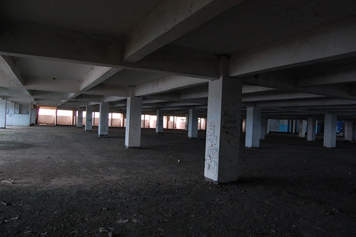
Abandoned parking lot, by Ikhlasul Amal.


Bell interviewed two business owners whose shops and restaurants neighbor the proposed garage, which is being developed under questionable financial assumptions by Opechee Construction of New Hampshire.

Both business owners rejected the conventional wisdom that more parking is good for economic development. "Nobody wants to walk around in a neighborhood full of parking lots," said Samantha Lindgren, co-owner of Rabelais. "It's discouraging," agrees Nancy Pugh, co-owner of Duckfat and Hugo's, two of Portland's more successful restaurants.

Bell also reveals that the City is paying $64,000 a year to subsidize a half-empty high-rise parking garage right across the street. That's because the City's former Economic Development Director, Jack Lufkin, agreed to guaranteed lease payments to help finance that garage at the peak of the real estate bubble.

View Downtown Portland Parking Lots in a larger map

Map showing the proposed new parking garage (center), across India Street from the new, city-subsidized Ocean Gateway Garage (center right), and other neighborhood parking lots and garages in red.

Amazingly, Lufkin stands by that deal to this day, claiming that "the lack of parking is among the biggest obstacles to development in Portland."

This is pure bullshit. There are numerous factors that are keeping developers from raising new buildings downtown. The most fundamental hurdle is the lack of potential tenants willing to pay rents that would be necessary to finance new construction.

Of course, this problem is closely related to the high cost of construction and land in downtown Portland, which are both artificially inflated due to City Hall's minimum parking requirements. The fact that so much real estate in downtown Portland is already occupied by parking lots makes the remaining land more expensive to buy and build on.

In other words, it's not the lack of parking that's impeding development; it's the fact that our city already wastes way too much real estate and money on parking quotas and subsidies.

But don't take my word for it. In 1998, Philadelphia Federal Reserve Bank economist Richard Voith pointed out that downtown areas have a competitive advantage in their walkable neighborhoods and cultural amenities. Building lots of cheap parking, he argued, "is unlikely to dramatically improve a downtown’s competitive position because the suburbs have a comparative advantage in land uses that demand a lot of space, such as parking lots and roads."

In other words, don't destroy an emerging urban neighborhood like the one around India Street by trying to make it compete with a strip mall hellhole like the one just over the bridge in Falmouth Foreside (where, for the record, an abundance of cheap parking has not rescued the town from a blight of abandoned box stores).

Lufkin was laid off in 2007 and now works for Gorham Savings Drive-Thru Bank, where he's probably bullying small business borrowers into sinking their limited capital into more asphalt instead of in their payrolls, equipment, or actual growth.

But wait! Here's one other out-of-towner who thinks that giving over half of the neighborhood to parking garages is a good idea:
When it comes to attracting development, there's no such thing as too much parking, said Nicholas Iselin, director of development and construction for Intercontinental Real Estate Corp., which owns the garage today."
Sure, if I were getting a $64,000 check every year from city taxpayers for an empty parking garage, I might feel the same way. Why not tear down the entire neighborhood for taxpayer-subsidized parking garages?

Back in the real world, it's hard to see how this new garage is going to make any financial sense for Opechee, the developers, when the city can't even give the stuff away right across the street.

Of course, they haven't started construction yet, so they and their financial lenders still have some time to come to their senses...

Friday, March 5, 2010

The working parking waterfront

Kudos to reporter Tom Bell for bringing attention to the over-supply of cheap parking - on waterfront property, no less, in today's Portland Press Herald. Bell notes that "Until the middle of the last century, when Portland's waterfront was a hub of transportation and fishing activity, the piers were covered with buildings, including warehouses for grain, molasses, coal and wood."

This was the city's working waterfront heritage, which everyone wants to preserve and protect.

However, Bell goes on to observe that "Most of those buildings have been demolished over the years, and today more than three-fourths of the area that could be developed in the central waterfront zone has no buildings. Instead, there is plenty of parking."

It's got some choice quotes, including:

“We don’t have a working waterfront. We have a parking waterfront,” said Don Perkins of the Gulf of Maine Research Institute.
This is kind of a dangerous idea. Portland prides itself so much on its working waterfront - the handful of bait shacks, trawler berths, and chandleries that still remain on the city's piers. Speaking the truth - that 3/4 of the "working" waterfront is really just a big parking lot - really deflates this big source of the city's pride.

Even the hotel and convention business, which is traditionally been seen as a prime economic adversary of marine industrial uses on the city's piers, agree that the acres of empty lots are a blight on the waterfront:

More public transit is the key to eliminating parking lots on the waterfront, said Barbara Whitten, executive director of the Convention and Visitors Bureau of Greater Portland. "A sea of cars," she said, "is not an attractive way to market the waterfront."

Read the full article here.

Wednesday, February 3, 2010

Budget crisis? Let's stop wasting space.

Our city, like most governments in America these days, is in the middle of a big budget shortfall. They're cutting school programs, raising bus fares, and laying off social workers. The city's main source of revenue is a 1.8% property tax, which is already high by Maine standards - the city can't raise it much further without sending more development and investment into the suburbs, and sending more homeowners into foreclosure.

On the face of it, it looks pretty hopeless. But in fact, City Hall has millions of dollars in costs that, out of pure neglect, it's been hiding off of its balance sheets. They're not in the schools, or in homeless shelters.

They're the opportunity costs of the city's acres of parking lots.

Here's an example - the East End School has a half-acre off-street lot on North Street. It's got gorgeous views of Back Cove and Casco Bay, it's across the street from the community gardens, it's a desirable neighborhood - and we're using this space only 15% of the time, for private vehicle storage during school days. This is self-evidently stupid, isn't it? And yet, there it is.

What if, instead, we made those few drivers park in the abundant on-street spaces on North Street and the Eastern Promenade (or walk, or take the bus), then sold this half-acre on the open market, no strings attached? Even in this economy, such a desirable location would fetch a lot of money - probably at least $400,000, which happens to be roughly 5% of the school system's budget shortfall this year.

And that's not all. If this half-acre of hilltop land goes to the private sector, it's all but certain that some developer will want to build something there. Most likely it would be homes, which is something our city needs more of. Let's assume they build 8 townhomes for $210,000 each. Then the city will collect 1.8% every year in property taxes - or about $30,000 in new revenue total. That's enough to cover the entire East End School's annual supplies budget.

And another thing: if we sell a pointless parking lot on the open market, the East End School will save a few thousand dollars every year in avoided pavement maintenance and plowing costs. It would become somebody else's problem, instead of the taxpayers'.

What do you think would make the teachers at the East End School happier? Having very convenient off-street parking, or having THEIR JOBS and A REASONABLE NUMBER OF STUDENTS IN THEIR CLASSES?

This is just one single parking lot. There's also Reiche School's 1/4 acre parking lot on Brackett Street in the West End, the 1/2 acre of parking at the corner of Stevens and Pleasant Ave (the very center of Deering Center), and the huge 6 acre front lawn of the PATHS school on Allen Avenue. All told, selling this land could recoup 1/3rd of the school budget cuts this year, and start generating new property taxes immediately for future years, and trim the school system's property maintenance costs.

And that's just the school system. Think about the Portland Housing Authority, which is hoarding acres of parking lots in the West End and East Bayside. Selling some of those lots into private ownership wouldn't just help the budget - it would also introduce a measure of stability and new housing opportunities into some of Portland's most depressed, rental-dominated neighborhoods.

But the biggest opportunity is the city's parking management itself. By charging below-market rates for parking on the city's streets and in its garages, the tiny little Parking office might rank as one of the most expensive in City Hall: it's hiding tens of millions of dollars from the city's balance sheets, from unaccounted parking subsidies to lost tax revenues. Our city's parking manager could have worked for Bernie Madoff.

So, I ask you again: what's more important? Solvent schools, a social safety net, and decent public services, funded by the development of new housing opportunities?

Or free parking?

Thursday, November 19, 2009

The Difference Four Feet Makes

Over the long summer construction season, 3/4 of a mile of Read Street in Portland's Back Cove neighborhood was torn up and rebuilt as part of the city's sewer upgrades program. The project is nearly finished, and here's a photo of the new Read Street:


It may not look like much, but believe it or not, this represents one of the more significant livable streets victories for Portland this year. That's because the new Read Street is 4 feet narrower than the old Read Street - and while that in itself is a relatively minor change, it could be the start of a big trend across the city and even the entire state.

Obviously, narrowing the street - from 36 feet to 32 feet wide - is going to slow down traffic through the neighborhood. Especially when people start parking their cars on the street, and narrow the effective width of the street to 24' or 16'. That's going to make people safer, and it's why Read Street's neighbors fought hard for the change.

But for City Hall, there was a much more powerful argument for a narrower Read Street: it costs much less to build and maintain. Light duty pavement is about $3 a square foot, so saving 4 feet of width, over the .75 mile length of Read St., would save the city $3*4*.75*5280 [the number of feet in a mile]=$47,520 in construction costs - enough to hire a new teacher for the schools.

And that's just for the short term - the long-term maintenance savings will be even greater, since there will be less roadway to plow, salt, and sand, fewer potholes to fill, etc.

Then there's the fact that this whole project is designed to separate the storm sewers, which carry street runoff, from the sanitary sewers: the combined sewers that are being replaced had a nasty habit of overflowing into Back Cove during rainstorms. The new system will carry sewage from houses and businesses to the treatment plant, but most of the storm runoff from streets is going to be dumped into the Cove, along with whatever garbage might have been in the gutters. So the city is taking a general policy of reducing "impervious surfaces", in order to let as much rain as possible soak into the ground before it goes down storm drains.

Making the street 4 feet narrower gives falling rain less space to flood the street, and more space to soak into the ground. Along the 3/4 mile length of the project, there's going to be a total of 16,000 additional square feet of soil, grass, and tree roots instead of pavement. In a 2-inch rainstorm, that will prevent about 1700 gallons of runoff from polluting Back Cove.

So: the neighborhood gets a safer street. City Hall saves tens of thousands of dollars. Back Cove gets cleaner, and ratepayers pay less on sewer bills. Wins all around.

So how could this not catch on? The state DOT is projecting highway fund shortfalls of up to $380 million a year in the next decade. Spending money on unnecessary pavement ought to be something they'd want to avoid. But then again, the good old boys in Augusta just love pavement SO MUCH, it's hard for them to tear themselves away.

Wednesday, January 14, 2009

Cheonggyecheon


Cheonggyecheon is a small stream that once flowed from a cirque of mountains that surround the historic center of Seoul into the Han River, 6 kilometers away.

In the years immediately following the Korean War, Cheonggyecheon was overrun by informal refugee camps, shantytowns, and sewage. The stream was soon paved over for a wide boulevard; in 1968, during Korea's own urban renewal fad, an elevated highway was stacked above the road. In spite of its historic and cultural significance to Korea, Cheonggyecheon spent over half a century in an underground culvert, choked with filth.

Then, in 2003, in an act of political will that seems miraculous to me, Seoul mayor Lee Myung-bak began a project to remove 16 lanes of stacked expressway and restore the lost stream beneath. Two years later, a vibrant, wild park had replaced a traffic-choked freeway. Believe it or not, the two photos above show the same section of stream (the two buildings in the center-right of the top photo, taken sometime early in the 2000s, are the same two buildings on the left side of the bottom photo).

Tearing out a huge downtown freeway didn't create mass gridlock, as the project's opponents had promised: traffic actually moves faster and more smoothly today than it did when the freeway was there. In an interview with the Guardian two years ago, Kee Yeon Hwang, a professor of urban planning, said that "as soon as we destroyed the road, the cars just disappeared and drivers changed their habits. A lot of people just gave up their cars. Others found a different way of driving. In some cases, they kept using their cars but changed their routes." In other words, people aren't as stupid as traffic engineers think they are. Koreans gave the project a definitive seal of approval when they gave Lee Myung-bak, the project's primary political champion, a promotion to the presidency in 2007.


By replacing idling cars with a naturalized waterway, Seoul also lowered summer temperatures in the center of the city and improved air quality and circulation. The Cheonggyecheon isn't yet a functioning watershed: the water flowing from the "headwaters" in the center of Seoul is currently being pumped uphill from the Han, instead of trickling down from the mountains. But it's still attracting wildlife, including fish and herons, and there are more plans in the works to restore elements of the stream's natural hydrology.

Of all the parts of the park I've looked at, this one's my favorite: three remnant highway abutments standing in the middle of the stream like a utopian apocalypse scene - a glimmer of hope that the brutal regime of freeways and highway engineering is losing its grip on the world's cities. Credit for the photo goes to Flickr user Ben Harris-Roxas:

Friday, April 4, 2008

The million dollar parking lot

I've written before about how the new Maine Turnpike Headquarters Building won't include new sidewalks on Jetport Road because Turnpike hacks explicitly stated their disapproval of pedestrians walking in the area (see The Maine Turnpike Authority Resents Your Legs, published July 5 2007).

But that, alone, would be too benign an indignity for a neighborhood subjected to a Turnpike construction project. So the Authority also is planning to build an unnecessary parking lot that will send more oil-soaked runoff into Maine's most polluted watershed - and tollpayers will pay the million-dollar bill.

Portland's suburban office-park zoning in this neighborhood already requires more parking than ever gets used, but the Authority decided to tack on an additional 50 parking spaces than required by those generous requirements. At approximately $20,000 a pop, these extra parking spaces will cost an additional $1 million dollars - your toll revenues at work to keep the glorious promise of Socialized Parking alive!


Obviously, it's highly unlikely that these fifty extra spaces in the distant hinterlands of the Turnpike Authority's new parking lot will ever be used.

But hey, the Turnpike wants to be EXTRA SURE that no one will EVER have to walk an extra 1/10th of a mile from the existing park and ride lot to the new headquarters building. The million dollar parking lot rescues Turnpike employees from the heart-straining indignity of walking 200 yards from their cars to their offices.

Unfortunately, we're not just paying for this extravagance in toll money: this parking lot happens to sit in the headwaters of Long Creek, the state's most polluted watershed and currently the subject of a Clean Water Act lawsuit. Because of excessively huge parking lots like this one, development throughout the Long Creek watershed (in the heart of Maine's largest metropolitan area) will be severely hampered, and Casco Bay's water quality will continue to suffer.

One reason why the Turnpike Authority subscribes to the narrow-minded maxim that more pavement is good for our economy is because of its consistent failure to acknowledge the costs and impacts that its pavement exacts on surrounding infrastructure, whether it's built (dumping traffic and congestion onto local streets and roads), social (draining life and commerce from walkable downtown areas in Portland, Biddeford, and Lewiston) or natural (sending oil-soaked runoff into wetlands like Long Creek).

It would be nice if the Turnpike Authority spent our money at addressing some of these real problems. Instead, they're throwing millions around to study and "solve" problems they've fabricated themselves in their compartmentalized fantasy world.

Fortunately for the rest of us, the longer they fail to reform themselves, the less viable their agency will be in a century of expensive oil and limited budgets.

The Maine Turnpike Authority is busily paving the way to their own irrelevance.

Thursday, January 31, 2008

Years of traffic engineering, rejected

Despite the highway engineers' best efforts to make people leave early with their skull-numbing Powerpoint slides on "level of service" and "ramp geometry," roughly 100 people from all over the greater Portland region stuck it out and voiced their lack of confidence in Maine's highway-biased Department of Transportation at last night's public meeting on Interstate 295 widening proposals. Here's this morning's Press Herald story.

We even got deputy commissioner Greg Nadeau to back off of his assertion that a "tsunami" of traffic was coming at us whether we build highways or not (in fact, with rising gasoline prices in the years since the study began, traffic statewide has actually decreased). The citizens in the room were too smart to swallow that tripe, and they let him know it.

The challenge now will be for citizens to hold these bureaucrats accountable and to make sure they don't ignore or make empty gestures towards our concerns, which has been the Dept. of Transportation's traditional modus operandi.

We can do that both by demonstrating sustained opposition to the incomplete and biased I-295 study - making it clear that the people of Maine will neither accept nor pay for its recommended "strategies" - and by writing to the governor to make sure that he is aware of the public lack of confidence in his Department of Transportation (governor@maine.gov). Here are some talking points for Gov. Baldacci:

  • Your administration has admirably committed itself to the ideals of Maine’s “quality of place,” to reducing greenhouse gas pollution, and to spending limited financial resources in a prudent and sensible manner. However, your Department of Transportation’s "Interstate 295 Corridor Study" is a brutal contradiction of these sensible principles.

  • Widening and accommodating more traffic on I-295 will generate more congestion on local streets in service-center communities, where local property taxes will have to shoulder the burden to deal with additional traffic, parking, and pollution.

  • According to its own projections, MDOT's highway recommendations will increase greenhouse gas pollution by thousands of tons every year, which would force the entire state's industries and electric ratepayers to pay more in order to meet our greenhouse gas reduction goals.

  • Spending hundreds of millions of dollars on new pavement and roadwork on a few miles of highway in Portland makes no sense when the entire state's bridges and highways are crumbling for lack of funding.

  • This agency willfully ignores more cost-effective transit solutions at a time when buses and new rail services are both desired and necessary to deal with rising costs of congestion and gasoline.

  • The bureaucracy that produced the I-295 Corridor Study is out of touch and out of line: your administration needs to reject its recommendations and make swift changes to bring this agency into the 21st century.

The public can demonstrate its rejection of the I-295 plan's recommendations at the next meeting of the PACTS (Portland Area Comprehensive Transportation Study) high-priority projects committee. At this meeting, on February 12 at the former Doubletree (now Clarion) Hotel in Portland, PACTS will evaluate which projects it will send to Washington for earmark requests. Currently, this list includes a several of the ill-advised I-295 widening and interchange projects discussed last night, so this is the public's chance to starve the beast of funding and to buy something more worthwhile (like new transit services) instead. I'll post more details here as the event approaches.

Sunday, January 27, 2008

Hidebound Departments of Transportation

This editorial from today's New York Times is ostensibly talking about Connecticut, but the subtext to Mainers should be obvious:

With the state’s highways inching ever closer to gridlock in recent years, a major project was undertaken to install a new drainage system and widen Interstate 84, which enters Connecticut from upstate New York and winds through Danbury, Waterbury and Hartford. It made traffic a nightmare, but commuters looked forward to clear roadways when it was done.

Well, not quite. It turns out that the state Department of Transportation, a notoriously hidebound agency, had arranged for contractors to both build and inspect the system. Surprise! When everything was finished, virtually every detail was constructed wrong... The state is suing, the F.B.I. is investigating, and Gov. M. Jodi Rell called for a top-to-bottom study last year of how the D.O.T. conducts business.

Preliminary results of the study are in, and they are not pretty. The department, decimated by early retirements several years ago, has a management model based on the Soviet Union’s. It takes as long as seven months to hire a low-level clerk. Any attempt to innovate, or even attend a meeting on innovation, requires the permission of so many higher-ups that few employees bother. Information on the agency Web page is years out of date. The department lets itself be pushed around by little towns that fight change and dole out commuter parking permits like country club memberships.

The good news? Ms. Rell is searching for someone to head the agency, and we encourage her to be bold so the transportation apparatchiks learn revolutionary thinking. Maybe Mikhail Gorbachev is available.

A hidebound DOT? I don't know what's more surprising, the fact that the Times considers this news, or the fact that they singled out Connecticut instead of Maine.

Speaking of which, you can read the latest repulsively stale widening proposal from Maine's DOT on the agency's I-295 corridor study website, which, like Connecticut's, contains "information" that is mostly two to three years old. But not without its arch humor: "Your opinion and feedback is [sic] important to us," they tell us. Rim shot!

But seriously, folks. We all have a chance to meet these jokers live and in person this Wednesday, 7 pm, at City Hall. If you'd like to spend $100 million (an amount equivalent to the state's entire budget shortfall this year) on a six-lane, New Jersey-scaled freeway running through the middle of Portland, here's your chance to congratulate MDOT on a job well done.

And if you think that this might not be the greatest idea, here's a rare chance to hold some Augusta bureaucrats accountable.

If you have a strong stomach, you can take a look at MDOT's recommendations for I-295 here. Just try not to think too much about how much time and money our "public servants" in Augusta wasted on this pile.