A blog for better streets and public spaces in Portland, Maine.
Showing posts with label citizen planning. Show all posts

Tuesday, March 11, 2014

Will "The Forefront at Thompson's Point" scuttle a key link in Portland's Bikeway Network?

On the western edge of the Portland peninsula, the Mountain Division railway offers a scenic direct route between Portland and downtown Westbrook — and from there, on to Windham, Standish, and Fryeburg. The corridor (shown in red in the map below) has long been envisioned as a regional bike and pedestrian connector — a safe and scenic alternative to travel along the outer Congress Street bottleneck.


A 10-foot-wide shared use path (highlighted in green) already extends from the Portland Transportation Center, the easternmost point of the Mountain Division line, along the Fore River Parkway to Veterans Bridge and West Commercial Street, where another trail connection into downtown is in the works. The next link westward would go through the planned Thompson's Point development to the area behind the Westgate shopping center.

That development, called "The Forefront at Thompson's Point," has spent several years in limbo, but it's going back to the Planning Board yet again on Tuesday to seek approval of a scaled-back Master Development Plan.

And unfortunately, the developers' new Master Plan cuts the Mountain Division off in favor of a surface parking lot. A trail could be carved out from portions of a single row of parking stalls, but the developers say they can't sacrifice 12 or so parking spots in a development that's planning to construct 1,290 parking spaces in all.

The good news is that city staff are pressing the developers to be more creative and figure out a way to fit the trail in. It's helpful that the trail corridor is in the city's official Comprehensive Plan, as part of the "Planned Bikeway and Pedestrian Network" approved by the City Council in December 2012.

If you want a safe bike and pedestrian link between the Portland Transportation Center and the Stroudwater neighborhood (and eventually on to Westbrook), chime in now by sending an email to the city's Planning Board and the City Council.


Sunday, March 9, 2014

Bike lanes and a side path could be built this summer on West Commercial Street

The proposed expansion of the International Marine Terminal's cargo facilities on West Commercial Street (under the Casco Bay Bridge) might bring a big influx of state transportation funds to Portland this summer — and with those funds could come new bike and pedestrian routes along West Commercial Street.

In order to accommodate more activity and a new freight rail line in the area, the state is planning to rebuild sections of West Commercial Street between Veterans Bridge and the Casco Bay Bridge. This is a significant bike route, and there are already city-adopted plans to extend the Veterans Bridge off-street path eastward towards downtown. The International Marine Terminal project might turn those plans into a construction project as soon as this summer.


Right now, Commercial Street is a bumpy road with no sidewalks between Bernie's Clam Shack (near the Western Prom, where an asphalt path leads to Veterans Bridge) and the Star Match building on the eastern end near Beach Street. That asphalt sidewalk near Bernie's was designed to be an off-street shared-use path, and this project could extend that pathway all the way to Harbor View Park, under the Casco Bay Bridge. The rebuilt Commercial Street might also include new on-street bike lanes, plus an improved, traffic-calmed intersection at Beach Street.

Although the project is fast-tracked and could begin construction this summer, the actual plans are still up in the air. Bike/ped advocates are encouraged to weigh in at a public meeting this Wednesday, at 6 p.m. in City Hall's State of Maine room (that's upstairs, in the western wing of the building).

Wednesday, September 4, 2013

Where should new bike racks go?

The Portland Bike and Pedestrian Advisory Committee is crowd sourcing potential locations for new bike racks in Portland. If there's a spot where you wish there were more bike parking, add a marker to the map:

Portland Maine Locations Where Bike Racks Are Needed

Monday, August 19, 2013

Tiny illegal streets

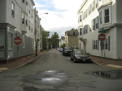
The City of Portland's "technical manual" spells out precise engineering standards for the city's streets: they need to have two 14' travel lanes, 6 feet of grass on either side, and 5' sidewalks. These standards were spelled out decades ago, when automotive travel was the top priority in street design. Freeways use 14 foot lanes, but most of the city's historic streets have 10' lanes. The extra width lets motorists speed through neighborhoods with a minimum of attention paid to their surroundings.

This, thankfully, is finally being reviewed for changes in accordance with the city's new "complete streets" resolution. And a good thing, too, because a number of the city's best neighborhood streets are completely illegal according to the old standard. With new, more flexible rules in place, the city might gain more great places like these:

Tate Street, West End:


Summer Street, West End:

Dermot Court, West End:


May Street, West End:

Maple Street, downtown:
South Street, downtown:

Oak Street, downtown:

Casco Street, downtown:

Locust Street, East End:

Wednesday, June 19, 2013

New bike paths, traffic calming in the East End

The city is finally building long-planned access improvements from the East End to Tukey's Bridge (in order to fix some of the problems I blogged about six years ago). I was walking in the area this afternoon and, even under construction, they're already doing a great job of slowing down traffic that comes into town off of the freeway:


The project is tightening up the wide intersection of the Eastern Prom Road with Washington Avenue (at left) and adding a landscaped median where pedestrians can wait. Cars are already driving through the area much more slowly than they used to.


This view, looking north on Washington towards the bridge, shows how much wider the new bike/ped path (the dirt area) will be compared with the current sidewalk (still visible in the foreground), and how much shorter the crossing distance is on the new crossing of Washington:

 The path shown above extends all the way to the Tukey's Bridge ramp, where another new bike path will connect down the hill to the left to join up with Anderson Street and the Bayside Trail.

Kudos to the city's bike/ped committee, PACTS, and the City of Portland for making this happen!

Monday, June 10, 2013

Tonight: final public meeting for Libbytown freeway ramp removals

Tonight at the Clarion Hotel near the Portland Transportation Center (on bus line 5) from 6:30 to 8:30 pm will be the final public meeting of the "Libbytown Circulation Study," which I'd written about previously here.

This will be the final meeting before the consultants present their recommendations to the City Council for endorsement. Word has it that they'll propose removing most of the connecting on- and off-ramps to Park and Congress Streets (shown in red below), except for the northbound on-ramp from Park Ave. This would open up acres of land for transit-oriented redevelopment.


Other positive elements of the plan would add sidewalks on both sides of Fore River Parkway to the bus station, shrinking the intersection of Fore River Pkwy. and Congress Street, new traffic calming, improved sidewalks, and landscaping elements on Congress and Park, and new, high-comfort bikeways that would connect the bus and train station to Deering Oaks Park and the Bayside Trail.

The public will have additional opportunities to weigh in on the plan when it goes to City Hall, but if you've got a free evening, consider coming down to Libbytown tonight to see what's in the works and express your support for a significant pruning of freeway infrastructure.

Wednesday, May 8, 2013

Also tonight at City Hall: bikeshare planning forum

There's actually a double-feature of public meetings for city-changing sustainable transportation initiatives tonight at City Hall. In addition to the hearing to remove freeway ramps in the Libbytown study (which I'd mentioned yesterday), we'll also have planners in town from the federal Environmental Protection Agency to help Portland set up a public bikesharing system (previously blogged here in February; more details in today's Press Herald).

The bikeshare public forum will be upstairs in the State of Maine room this evening from 5:30 to 7. The Libbytown meeting is happening in the basement level, Room 24, at the other end of the building. Stop by both!

Tuesday, May 7, 2013

Public hearing on Libbytown freeway ramp removals

Tomorrow, the Libbytown Traffic and Streetscape Study holds a public workshop at Portland City Hall, Room 24, from 5 - 8 pm (entrance is off Myrtle St. on the east side of City Hall). Displays illustrating the proposed changes will be available from 5-6:30 pm and 7-8:00 pm for comments, with staff available to answer questions. A presentation on the neighborhood conditions and the proposed changes will take place from 6:30 - 7 pm.

This study is a pretty big deal: it proposes to remove multiple freeway ramps that connect to Congress and Park at the western gateway to the city, immediately adjacent to our bus and train station (in fact, the cruddiness of this intersection was one of the first things I blogged about when I first moved to Portland years ago). 

All of the alternatives under consideration would sell off acres of empty space currently occupied by looping freeway ramps and make that real estate available for transit-oriented infill development, like housing or offices. All alternative would also install high-quality, separated bikeways to connect the bus and train station to downtown Portland, plus better sidewalks and calmer, smaller streets throughout the neighborhood.

Doing these things would be relatively cheap, and could be implemented in the next few years, but only if these ideas receive public support.

Here's my personal favorite option, alternative 1b (note the conversion of a freeway ramp into a bike path, which could extend all the way into Deering Oaks Park and ultimately connect to the Bayside Trail):


Click here for a more complete view of the alternatives being proposed.

Monday, March 4, 2013

Another choice for Congress Square

As many readers of this blog undoubtedly already know, the task of improving the mediocre public space at Congress Square has had the attention of a city-appointed advisory committee for some time now, and the new owners of the Eastland Park Hotel have pitched a proposal to buy most of the park's real estate from the city and turn it into a ballroom for conventions and events.


Unfortunately, the Eastland Hotel's proposal has galvanized the debate. On the one hand are out-of-town hedge fund managers who want to convert public space to private use. On the other hand are suburbanite activists who are treating this half-acre of downtown Portland like it's Yosemite Valley. The goal of creating a higher-quality public space that benefits the entire neighborhood has been mostly lost in the shuffle.

So thanks to Clifford Tremblay, an architect who recently moved to Portland, for trying to change the conversation. Clifford pitched these ideas for Congress Square at a Portland Society of Architects "Drink 'n Crit" earlier this winter (I was on the design jury while he presented this concept and I'll try to paraphrase his pitch here).

Courtesy of Clifford Tremblay


Clifford's proposal consists of two fundamental elements: activating the center of Congress Square by inviting through-traffic, and activating the edges of Congress Square with new uses and friendlier edges.

As for the first challenge — getting more people into the center of Congress Square Park —  Clifford proposes a new diagonal orientation for the park, to encourage cut-through foot traffic from Congress to High Street (see site plan above). The center of the park would become a secondary pedestrian-oriented street, defined by a row of trees and a water feature. Clifford makes the point, echoing a number of other architects and members of the citizens' advisory committee, that the current park's sunken design, with several steps leading down into the park from Congress and High, should be eliminated. Clifford would level the park with Congress Street, and relocate a more modest set of stairs leading up to the park to the western edge of the site.

Courtesy of Clifford Tremblay

The second crucial aspect of Clifford's proposal — and again, it's an idea that's been echoed by several architects, business owners, and neighborhood activists — is that the edges of Congress Square need to be more porous in order to invite more public use and public ownership. The sketch above shows a view of Clifford's proposal from Congress Street, with the Eastland hotel in the background. Note the active sidewalk dining on the eastern side of the park (this building, the former "The Kitchen" restaurant, is supposedly under contract to become a new haute-cuisine restaurant). The northern corner of the park, currently a no-man's land of bleak shrubs, is here transformed into a more inviting — yet still relatively secluded and quiet — spot for tables and a performance stage.

At the rear of the site, Clifford has optimistically suggested new windows and awnings to the Eastland Park Hotel's facade (currently a blank wall painted with a mural). Last of all, note the previously-mentioned lack of stairs between the sidewalk and the park. Sure, it's just a Sketchup drawing, but it looks a lot more inviting, doesn't it?

The primary strength of the ballroom proposal from the Eastland is that it provides an economic development boost to this part of the city. Still, what they're pitching isn't nearly good enough to overcome the opposition's strident concerns over the loss of open space. I don't particularly agree with those concerns, but from a purely pragmatic perspective, the owners of the Eastland need to do a whole lot better in terms of their own designs (a preliminary and pathetic example of which is pictured at left) if they really want to convince the public to surrender the less-than-perfect status quo.

This is valuable real estate in the heart of the Arts District. What if the City built — and collected rent on — a row of small artists's studios built to screen the Eastland Hotel's blank walls? What if the City leased park space to the new restaurant on the Congress Street side? These new uses could generate new rental revenue to support park renovations, while adding to the park's vibrancy as a public space, and improving property values in the surrounding neighborhoods. The Eastland Hotel's current proposal frankly can't compete with these possibilities.
 
This is still public space, and Portlanders absolutely should demand a higher standard of design. Thanks to Clifford Tremblay for changing the conversation in the right direction.


Sunday, October 28, 2012

Portland's new Bicycle and Pedestrian chapter of the Comprehensive Plan

Please note that this meeting has been rescheduled to November 5th due to Hurricane Sandy.

The Planning Board's next meeting, on Monday the 5th, will workshop the rough draft of Portland's new Bicycle and Pedestrian chapter of the Comprehensive Plan (download the PDF here).

The plan includes a map of planned citywide bike routes, cyclist safety education initiatives, and a framework of "quality of service" engineering standards that will set measurable benchmarks for safer streets and sidewalks. This Planning Board workshop will be a chance for the Board and citizens to offer feedback and suggestions before the document goes to the City Council for formal adoption, which will give it legal force as a component of the city's comprehensive plan.

Tuesday, February 28, 2012

Portland's Proposed New Bike and Pedestrian Plan: Public Hearing on March 1, 6:30 pm

Grade "A": Bedford Street in the USM campus is comfortable to walk and bike along, or to cross as a pedestrian, and would therefore be considered a street with a high "quality of service" for bikes and pedestrians...

Grade "D": Forest Avenue in the vicinity of Morrill's Corner, with its high volumes of speeding traffic and lack of safe crosswalks, would receive much lower grades.

Failure: Franklin Street, with its complete lack of crosswalks or sidewalks, would receive an "F."
Portland's Bicycle and Pedestrian Advisory Committee (which I chair) has lately been working with city staff on a new chapter of the city's Comprehensive Plan that would be focused on improving the city's conditions for bikes and pedestrians.

The plan goes under the public's scrutiny for the first time at a public hearing on Thursday, March 1, at 6:30 pm in the Merrill Auditorium Rehearsal Hall (behind City Hall; entrance on Myrtle Street).

Pending its approval from the City Council, this plan would have a certain legal force under state laws like the Sensible Transportation Policy Act and the Comprehensive Planning and Land Use Act.

On a practical basis, that means that future real estate developments and road projects would have to abide by the plan's recommendations. One of its more exciting elements (to me) is how it would implement new "quality of service" measures for walking and cycling in various neighborhoods across the city.

Streets would be graded according to the quality of their crosswalks, the speed of traffic, and other factors that affect how useable and safe they are for pedestrians and cyclists, with particular focus on vulnerable users like kids and the elderly (see the examples at right).

The city would also set targets for various districts to achieve certain ratings: a neighborhood center like Woodfords Corner or North Deering would be held to a higher standard than an industrial area like Warren Avenue. And as new development occurs, builders and road projects would be held to those aspirational standards.

So, even though the area around the Northgate shopping plaza in North Deering might currently rate a "C" or "D" in terms of pedestrian quality of service, new road and building projects in the neighborhood would be expected to add wider sidewalks, better crosswalks, trail connections, and other amenities to aim for an "A" rating.

One drawback of the Comprehensive Plan is that it will take a long time to implement, because by default, change will only happen incrementally, as new road projects and developments come along.

To get things going a bit faster, one idea kicking around is adding in a recommendation for a dedicated source of funding for new bike routes and pedestrian improvements, perhaps through a 25 cent surcharge on hourly rates at public parking meters and garages, so that the city wouldn't necessarily have to wait for development projects to come along in order to make improvements.

It's unlikely that city staff will make a recommendation like that on their own, but if enough members of the public speak out, it could be more realistic. And if it were included in the plan, then City Councilors would have a chance to vote on a new source of funding, along with the plan's other good ideas.

You can download a draft outline of the plan, plus a map of proposed official city bike routes, on the City's Transportation, Sustainability & Energy Committee webpage.

Wednesday, May 25, 2011

What about a Streetcar in this Portland?


As a citizens committee mulls over how to improve Forest Avenue, I've been mulling over whether it might be a good place to try to build Maine's first modern streetcar.

I've run some back-of-the-envelope calculations, and I think that Portland could afford it - I'd actually go so far to say that Portland could easily afford it. It could well end up making the city fiscally better-off: smart-growth developers love streetcars, and a line along Forest could spur dozens of building projects to bring new thousands of new jobs and housing units into the corridor's empty and underutilized lots.

The stretch of Forest Avenue from Bayside to Woodfords Corner could be a really cool Main Street for Portland, similar to Congress Street downtown or Commercial Street in the Old Port. It's got a big university campus anchoring one end, and the down-on-its-heels-but-still-kicking Woodfords business district on the other, and a smattering of fine historic buildings and neighborhood attractions in between.

Unfortunately, a few businesses and landlords along the street are more interested in serving cars than in serving their own neighbors, and their drive-thrus and blighted parking lots are dragging the entire neighborhood down. Even the banks seem to be anti-development: two brand-new branches built within the past decade are killing the neighborhood's foot traffic (not to mention choke the neighborhood's vehicular traffic) with hideous drive-thru teller lines.

Still, a high-quality transit service might convince them that those parking lots and driveways might be more valuable as housing or workspace. By my rough count, there are over 20 acres of aging strip mall, parking lot, or empty land along the line from Woodfords Corner to downtown:


View Dowtown Streetcar feasibility in a larger map

If just a handful of those lots were redeveloped with 4-5 story buildings, the city could gain a few hundred thousand dollars annually in new tax revenue - enough to pay for the annual operations costs of a streetcar line. And many of these lots are owned by the government, from the Maine Dept. of Transportation's land-wasting Exit 6 interchange, to the extensive parking lots of the University of Maine Campus, to the City of Portland's public works lots in Bayside. The city and state could potentially sell 10-12 acres of downtown real estate, setting aside a few million dollars for a streetcar line and saving the rest for other programs.

The streetcar construction projects in the other Portland have averaged $12-$13 million per mile - a figure that includes road reconstruction work and the costs of the vehicles. The line I sketched out above would be 1.8 miles of track downtown, plus 2.4 miles of track out to Woodfords Corner and back (or 1.2 miles in each direction). Based on the ballpark $13 million per mile figure, Portland could buy this for around $55 million. And given that these streets will probably be reconstructed soon anyhow, the marginal additional cost would be substantially lower.

$55 million is a lot of money. But in terms of transportation investments, it's relatively cheap.The Jetport terminal expansion, for instance, is going to cost $60 million - funded by surcharges on our plane tickets. The old Turnpork Authority tollbooth proposal in York would have cost about $50 million. And widening Forest Avenue to accommodate more car traffic might easily run to over $100 million, in addition to the loss of dozens of taxpaying businesses and buildings.

Another thing to keep in mind is that the federal government matches up to 80% of our transportation infrastructure expenditures. If we could compete in effectiveness with other proposed streetcar projects in other cities, and earn the full 80% match, then City would only need to raise $11 million locally.

Still, even though a streetcar might be possible, it won't happen unless three very uncertain conditions are met:
  • key property owners along Forest Avenue and in Bayside get smart enough to replace their parking lots with new buildings, to help the line attract enough riders;
  • the surrounding neighborhoods remain open to having new neighbors, more businesses, and taller buildings along Forest Avenue, and
  • a leader in city government can champion the concept and secure funding from state and federal partners.
Right now, we have weak leaders, a lot of NIMBYism, and mostly unimaginative landowners. But maybe the idea of a high-quality streetcar line, and a fast connection to downtown Portland, could change things for the better.

Thursday, May 12, 2011

Transforming Forest Avenue - Corridor Walk and 1st Public Meeting

The Great Lost Bear is the same distance from Monument Square as the Western Prom (about 1.3 miles) - but while a walk through the West End is pleasant, a walk along Forest Avenue through the freeway interchange and along the strip of drive-through banks and fast food franchises is almost unheard of.

A lot of the city's planners and leaders would like to change that, so they've commissioned a study that's now underway called "Transforming Forest Avenue."

"The goal of this study is to develop functional and safe pedestrian, bicycle, bus and motorist access both along and across Forest Avenue - a key gateway corridor. This study will also look at land use, leveraging public investments to stimulate private redevelopment and infill of underutilized properties."
The study should also look at options for Exit 6, the cloverleaf freeway interchange that blocks Forest Avenue from the rest of downtown Portland.

The study's steering committee met for the first time last week. Unfortunately, it sounds from their reports that people aren't bringing a lot of vision or ambition to this - there's a lot of "sure, Forest Ave. is bleak, but what can you do?"

Hopefully, members of the public can come and change that attitude tonight, at the study's first public meeting, by bringing some big ideas and letting the planners know that this can and should be a walkable main street for the city.

Transforming Forest Avenue - Corridor Walk and 1st Public Meeting
May 12, 2011

Corridor Walk: 4:30 pm-5:45 pm
We will meet in front of the University of Southern Maine Glickman Library on Forest Avenue.

Public Meeting: 6-8pm
At the University of Southern Maine Abromson Center (on Bedford Street), Room 109-110.

For details, call Molly Casto, Senior Planner at 207-874-8901.

Monday, May 9, 2011

Portland Bike/Ped Advisory Committee - May Meeting

Tonight, Portland's Bike/Ped Advisory Committee meets at 5:30 pm in City Hall's Room 209. Come by and learn about what's going on with -


Monday, April 25, 2011

14 Acres of Waste: Portland's Exit 6 Interchange


I've written previously about what a mess Portland's Exit 6 interchange is. It's one of the most dangerous intersections in the entire state. It's unwalkable. It isolates the University of Southern Maine and the city's main grocery store (Hannaford's) from downtown neighborhoods and the city's largest park. And it takes up 14 acres of valuable real estate smack-dab in the middle of the city.


As Corey notes, there are no crosswalks and no "yield to pedestrian" signs. Foot traffic takes its chances with freeway-bound car traffic speeding as fast as 50 miles per hour through the center of our city.

Here's the good news, though: this summer, Portland and PACTS (the regional transportation planning agency) are undertaking a traffic and planning study of Forest Avenue from Deering Oaks Park to Woodford's Corner - including the Exit 6 area.

It's worth noting that this section of Forest Avenue is also "on the peninsula" - at Woodford's Corner, you're less than 2 miles from Portland Harbor to the southeast, and 1.5 miles from the Fore River estuary to the southwest, and less than 1/2 a mile from Back Cove to the northeast - but thanks to Interstate 295, it doesn't feel that way. What Portlanders typically think of as "the peninsula" - the neighborhoods on the downtown side of I-295 - is actually an island cut off from the rest of the peninsula by the freeway.

But this study aims to transform Forest Avenue into a walkable, urban 'main street," much like other peninsula streets like Congress, Middle, and Commercial.

Whatever that study's recommendations are, one of the first recommendations should be a project to shrink the outdated, land-wasting "cloverleaf" interchange into a smaller, more efficient "diamond" interchange, to free up at least 10 acres of land for sale and redevelopment, while also expanding Deering Oaks Park and the University of Southern Maine campus:


The proceeds from those land sales could then be used to rebuild the rest of the street, while also providing a new, long-term source of property tax revenue to the City of Portland.

The "diamond" design would also eliminate the hair-raising merge lane on the I-295 bridge over Forest Avenue, when entering cars going 20 miles per hour on the ramp's sharp curves have about 100 yards to accelerate to 50, merge, and dodge exiting cars slowing down.

Now, the traffic engineer's chief quibble with the so-called "diamond" interchange is that it forces motorists to take a left turns to get where they need to go (for instance, if you're coming from the south, and want to take Exit 6 to get to Woodford's Corner), and that requires traffic lights and long waits. In some cases, they say, traffic might back up onto the freeway.

This is kind of a moot point, since traffic already backs up onto the freeway thanks to Exit 6's terrifying merge lanes. But even so, it's an easy problem to fix: simply prohibit left turns at the exit and entrance ramps, force drivers to make right turns only while going onto or off of the freeway, and install two roundabouts on Forest Avenue to let drivers make U-turns in order to get where they need to go.

Here's a schematic of how it would work. On the left is how a driver makes a left turn in the current cloverleaf intersection, by using the I-295 bridge to fly over Forest Avenue, then doing a u-turn on the cloverleaf to merge with traffic on the right side of the Forest, towards downtown. On the right is how it would work with a smaller diamond interchange and 2 roundabouts on Forest Avenue: the driver would merge with traffic going in the opposite direction, then do his u-turn on the roundabout.

The chief advantages: 2 roundabouts take up a lot less space than 4 cloverleaf ramps. The roundabouts also help move traffic more smoothly AND at lower speeds on Forest Avenue, and they also offer safer crossings for pedestrians.

Here's how it might look in practice:

Those green areas are the acres of land that are currently taken up by the cloverleaf loops. Exit 6 is a bigger waste of land than even Franklin Street. Which brings me to the final, most important reason why this needs to happen: basic economics.

The state is broke. Gas tax revenue is tanking. The federal government is increasingly tight-fisted, and the City is also broke.

Therefore, any study that aims to "transform" Forest Avenue is a waste of time unless it can come up with a viable financial plan to make its recommendations happen. Selling 10 acres of in-town real estate could generate a lot of funding to make Forest Avenue better, and the buildings that might get built on that acreage could do a lot of good towards rehabilitating Forest Avenue as a real city street - not just a freeway exit.


Monday, March 21, 2011

Regional Commuter Buses Could Come Next Year - If Transit Advocates Speak Up on Tuesday

LD 673, An Act To Expand Fiscally Responsible Transportation through Increased ZOOM Bus Service, is a bill that would establish new express commuter bus services to serve downtown areas along the Maine Turnpike corridor - an important step towards building more sustainable communities, reducing transportation costs for governments and households alike, and reducing Maine's reliance on oil.


This bill would, for the first time, shift the Maine Turnpike Authority's spending away from expensive highway widenings, and towards cost-effective transit - saving Maine millions of dollars in tolls and gasoline costs every year.

I've been working on this bill with the Maine Alliance for Sustainable Transportation for several months now. I'm very pleased to say that its chances look good: we have enlightened new management at the Turnpike Authority in Peter Mills, and a long list of sponsors from both political parties.

Still, many of the staff of the old "Turnpork Authority" still have their jobs and still want to keep Maine dependent on oil and pavement. They're still spending lots of money on lobbyists to maintain the status quo as much as possible.

LD 673 has a public hearing tomorrow in the State House, in Augusta. We want to pack the room with transit supporters. You should come.

We'll be arranging carpools - RSVP on Facebook if you'd like a ride from Portland or Lewiston. Come tell our lawmakers that Maine needs this bill to pass this year!

Monday, February 14, 2011

Love Walking and Cycling? Come to Tonight's Bike/Ped Committee Meeting

It's a very romantic Bike/Pededestrian Advisory Committee Meeting tonight, starting at 5:30 pm in Room 209 (upstairs) of City Hall:


  • An update on Portland's first proposed "Neighborhood Byway" - a traffic-calmed route that would prioritize bikes and walkers on neighborhood streets between Deering Center and Sagamore Village

  • A call to action regarding grumpy drivers' efforts to remove a traffic calming median island on Woodford Street

  • Ideas for a bike route along outer Congress Street, from Libbytown to the Airport

  • Updates from Augusta (including the status of the Maine Alliance for Sustainable Transportation's ZOOM bus legislation)

We'll adjourn by 6:30 pm. See you there!

Friday, December 10, 2010

Bayside Ice Arena

Here's a good suggestion for a public space hack from Corey Templeton, from his blog Portland Daily Photo: turn the perpetual puddle on the City's Bayside lots into a public ice rink for the winter:


[photo illustration by Corey Templeton - click for a larger image from Corey's blog]

It's worth noting here that this empty lot is, indeed, a public space - it's owned by the city, and targeted for future downtown growth. Unfortunately, the City is simultaneously intent on flooding the office market with cheap, car-dependent cubicle farms in the city's outskirts - a confused economic development strategy that will likely keep this downtown lot empty (save for its puddle) for years to come...

Wednesday, October 13, 2010

TONIGHT: Portland Bicycle and Pedestrian Advisory Committee at City Hall

October's monthly bicycle and pedestrian advisory committee meeting has been rescheduled to Wednesday this week, due to the holiday on Monday. We'll meet at 5:30 pm, in Room 24 (in the basement level at the eastern end of the building) of Portland's City Hall.


At our last meeting, members voted to choose 4 top priorities we'd like to advance through the local and regional planning process over the next two years. Those priorities are:
  • Reconfiguring the Exit 6/Forest Avenue interchange to make it more pedestrian and cycle-friendly. The current cloverleaf interchange swallows up over 6 acres of valuable real estate and clumsily cuts off access from major pedestrian destinations like the USM campus, Deering Oaks Park, Bayside, and the Hannaford grocery store. It is a high-crash location for automobiles. It's dangerous for everyone and a waste of space, and it's time we made plans to fix it.

  • Bike Boulevard pilot project. Bike boulevards are low-traffic neighborhood streets that include traffic calming elements and other features to make them extra-convenient routes for bikes and pedestrians. We'd like to establish a pilot Bike Boulevard somewhere in Portland, and have it serve as a model for other routes connecting throughout the region.

  • Bayside Trail/Preble/Elm area of Bayside: Even though this neighborhood has seen increasing amounts of investment and new development, the streets are still relics of the days when this neighborhood was an industrial backwater. There are large gaps in the sidewalk network, one-way streets that are wider and faster than they need to be, and numerous blockages to handicap accessibility. Future development offers the opportunity for the city to make the neighborhood's streets much better.

  • "Bikes May Use Full Lane" signs. Many of Portland's larger streets, like Congress Street and inner Washington Avenue, don't have enough space for bike lanes, but they're still important connecting routes for bike commuters. New signs would educate motorists and cyclists alike that bicycles are allowed to use the full lane, instead of squeezing themselves into the gutter.
Do any of these ideas sound appealing to you? At this month's meeting, we'll discuss our strategy and convene small working groups of people who are ready and able to seize these ideas, move them through city and state approval and funding processes, and make them a reality.

Join us TONIGHT at 5:30 pm, in Room 24 (in the basement level at the eastern end of the building) of Portland's City Hall.

Thursday, October 7, 2010

"Peloton Labs" are under construction

The "coworking space" on Bramhall Square, which I'd blogged about a few months ago, is now under construction and seeking tenants. They're calling the place Peloton Labs.

Their new website is also soliciting ideas and suggestions from potential tenants - so sign on now to have a say in how the building gets built.

Also interesting: Neil Takemoto, author of the CoolTown Studios blog, seems to be involved as well - at least, he's posting things on the website. Neil was in town early this spring to participate in the East Bayside neighborhood design intensive. His blog is quite influential among creative economy wonks, so it's a good thing for Portland to have him involved in more projects here.