A couple of weekends ago I climbed to the top of the Munj to attend a community charrette for the future of the Adams school and the two blocks of East End neighborhood it occupies.
Billed as a workshop for "crazy ideas," the event was intended to guide the neighborhood association towards a set of goals and guidelines for a forthcoming Request for Proposals for the future development of the site. The ideas turned out to be not so crazy, for the most part - at least, no one proposed a space port or anything like that. More often, people struggled with the tradeoffs of more quotidian desires for a neighborhood with scarce land: Would the neighborhood like to see more housing or more parking? More retail space or more grassy lawns?
 We split up into three groups, each of which was guided by some Muskie School planning students and an architect or two to put our ideas on paper. We began by ranking our priorities for the neighborhood: family housing came up most strongly, but so did environmental sustainability and open space.
The conflict between these values struck me early on. Every additional quarter acre dedicated to "open space" means one to three families who won't be able to live in the East End (and they'll likely move to the hinterlands of Scarborough or Standish instead - certainly less than a "sustainable" outcome). Besides, the Eastern Prom, one of Portland's biggest open spaces, is just a short walk away from the school in two directions.
But we also discussed how the East End's plentiful open space is actually used. As it turns out, a lot of it isn't very functional: the majority of it is just a pretty frame for views of the ocean or (in the case of the park on North Street) of the White Mountains. A lot of East Enders use their grassy "open space" primarily as a toilet for their pets, if at all. Even if that is a valid priority, people generally agreed that it shouldn't outrank the need for in-town housing.
But the Adams School's existing playground isn't just a grassy lawn (although the site does have one, and again, it's a dog toilet). It's also an active playground and basketball court that's still well-used even two years after the school's closure. This, it turned out, was what the neighbors in my group really valued: not an empty field faking pastoralism in the middle of the city, but a busy, public square where kids could play and neighbors could meet.
So this is what we came up with:

Triple-decker rowhouses (purple) front Vesper and Munjoy and a new pedestrian court between Beckett and O'Brien Streets. A sun-facing playground and plaza (orange-ish, with green trees) open up along the southern end of the pedestrian connection along Wilson Street, and facing the plaza are storefronts for local non-profits (in blue), topped by additional housing. Two alleys (also orange) through the site access flexible storage space (pink) that can be used as parking or as studio space, at the owner's discretion.
Nan Cumming, who attended as a neighbor but also happens to be the executive director of Portland Trails, advocated early on for connecting O'Brien and Beckett Streets as a pedestrian thoroughfare. Also, our group considered reusing the school, but ultimately rejected the idea in order to make the most of the real estate, recycle the old building's materials, and build new, efficient buildings instead. A sub-group discussed possible ownership models for the housing and concluded that the project should sell affordable, deed-restricted condos built for and marketed to young families.
 Then we went to present these ideas to the other groups and hear about their own "crazy" (but not really) ideas. As it turned out, the other groups seemed to hold similar values: housing was definitely the most prominent element of every plan, as was a small playground or garden on the southern end of the site. The other two plans proposed reusing the existing Adams School building for "community" uses or as business incubators, but they also suggested hollowing out the middle portion of the building to provide the same pedestrian connection our group had proposed. No one wanted big parking lots (speaking of which, I wonder if anyone from Ocean Properties is reading this blog yet).
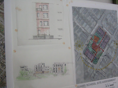
 This site plan came from the same group that created the lovely adaptive-reuse drawing above. They've got housing on the north side of the site, along Munjoy, and above commercial uses on Wilson, plus an urban square in the middle and a garden to the south. The school building is would be reused for "community" uses, although I'm not sure how "community" uses would fill all that space and I can't recall the details of their presentation. They proposed adding a sort of pedestrian arcade through the building (see drawing above).
The final group had the prettiest drawings (in my opinion) and the most urban site plan:

 They proposed four-story townhouses (top left drawing) along Wilson, Munjoy, and Vesper Streets, and a rehabbed school building with new additions for retail and business incubator space. I thought that their drawing of the reused school was particularly awesome (at right): a sort of warehouse/treehouse perches on top of the old school building with wind turbines.
However, all of the good-looking density that comes with this plan comes at a price: they proposed underground parking, which costs a lot more than surface-level lots or garages. While underground parking looks better, it would probably make the housing here prohibitively expensive for most people.
Now that the conceptual designs are in, the School Reuse Committee will consider the options in its final report to City Council, which will probably put out a Request for Proposals or a Request for Qualifications sometime soon.

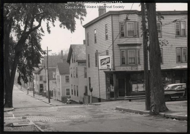
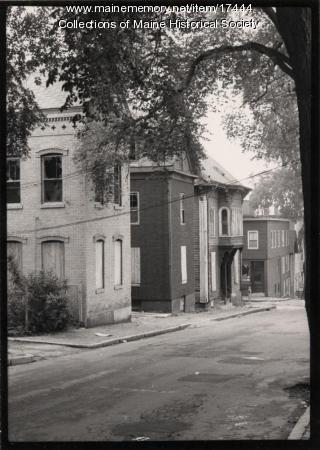
 Below, another photograph from the same site of another spot on the former Franklin Street. It's hard to know exactly where, since the buildings, shady elm trees, and even the sidewalks have been gone for decades. For those readers who have never been to Portland, here's what urban renewal gave us instead: a grass median full of garbage, some scrubby trees growing over the old neighborhood's rubble, and four lanes of traffic unencumbered by crosswalks or sidewalks. Here's a photo (the Franklin Towers, Portland's tallest building and a fine example of Soviet Sentimental architecture, commands a fine view of the no-man's-land):Note how all of these "slum dwellings" in the old photos bear striking resemblance to historic homes that now sell for over $1 million in surrounding neighborhoods. Way to invest in real estate, you jingoist highway-engineering dipshits.


 Learn more, and find out where you can purchase a copy.